
It’s a cold mid-February morning and I am headed to Namaze station just north of Takarazuka for a day hike. Along the old JR Fukuchiyama line there are sets of abandoned railroad ties and embankments that have been refurbished and repurposed into a hiking trail. The trail wends over 3 miles (5 km) from JR Namaze (生瀬駅) station to JR Takedao (武田尾駅) station. The trail is mostly flat and wide, which makes it great for young children, and features views along the river and surrounding countryside. Near the end of the hike, there is an old trestle bridge that crosses the river. A new wooden hiking bridge has been built over it to make it safer for hikers to get across.
Six tunnels along the hike add adventure and excitement to the trail
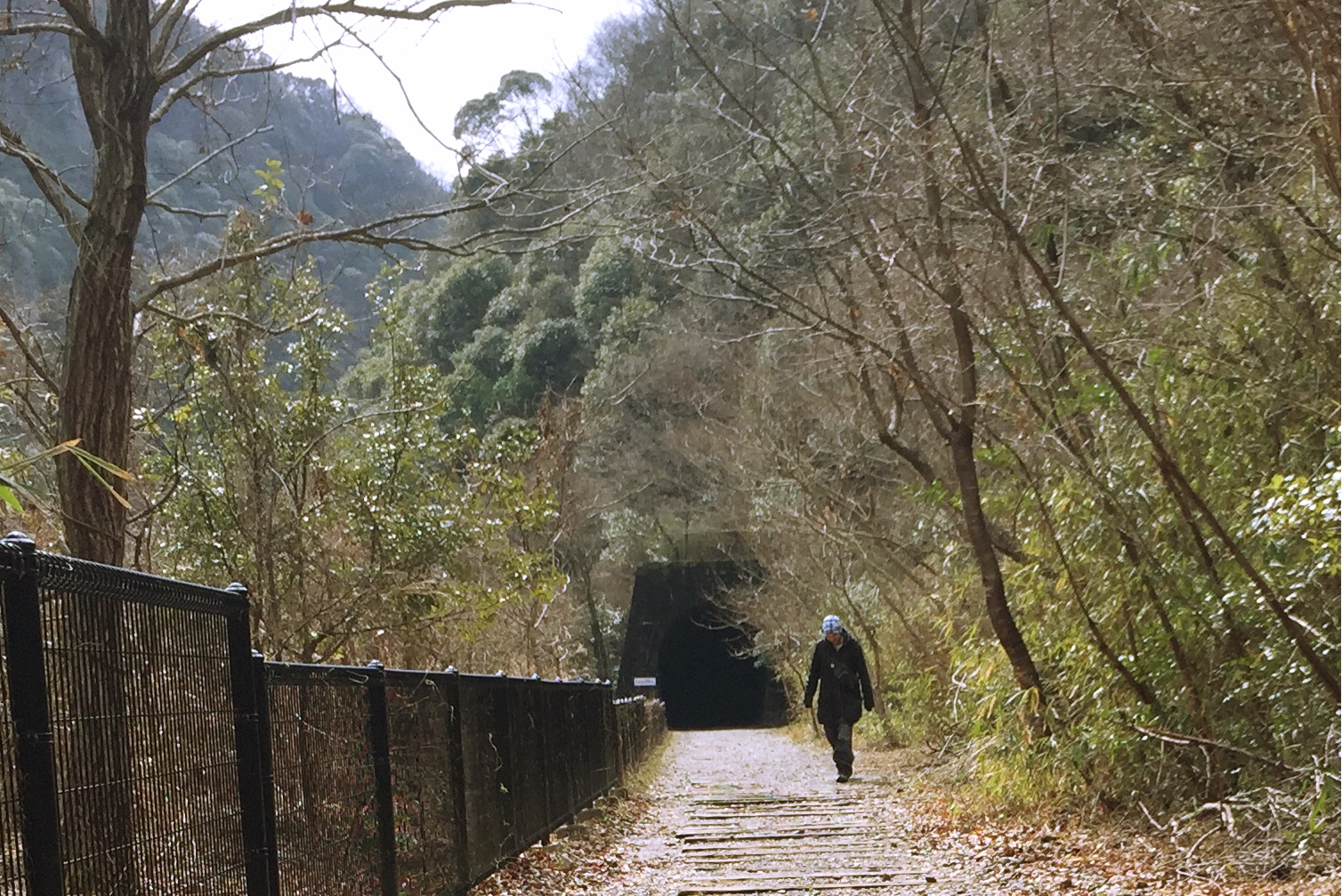
The most exciting part of the trail is a series of six tunnels built for the railway. None of the tunnels are illuminated, so headlamps and flashlights are needed to safely navigate the passages. The longest tunnel is 450m in length and features a bend that prevents either end of the tunnel exit from being seen. During our visit, we turned off our flashlights in the middle section of the tunnel, but the tunnel was too crowded with other hikers and their flashlights to leave us in complete darkness. We stopped for lunch at the entrance to the third tunnel on a pair of benches for a bento packed with tomatoes and fruit from the Kobe farmer’s market.
Getting to the entrance
The most difficult part of the hike is getting to the entrance! There are several step-by-step guides here and here with pictures. It’s important to remember that the entrance to the hike is about half a mile (~1 km) from Namaze station along a busy highway.
Step-by-step guide to the entrance of the hike
When you exit Namaze station turn right and walk down the hill past the convenience store on your left and underneath a small tunnel. After the tunnel, you will reach an intersection with a red bridge on the other side. Do not cross the street toward this bridge, but instead head left along the highway.Total walking time: ~7 minutes.
There is a narrow path with a steep embankment on your left and a guardrail on your right as you follow the main road toward a gas station. Just past this gas station and underneath a very tall highway overpass is a crosswalk that leads to the entrance to the hike. On the other side of the pedestrian crosswalk is a small black hiking sign that indicates the way to the trail. Total walking time: ~15 minutes.
You have to walk down a pedestrian only walkway, that leads on to a paved road. Turn right onto this road and walk through a small neighborhood of houses for about five minutes. There is a fork in the road – it doesn’t matter which one you take – they both will drop you down onto the dirt path and a white sign with the kanji (告) that marks the start of the trail. We first took the fork on the left, and when it narrowed and went down a hill, we weren’t sure it would continue and circled back to the right fork. Other cars were traveling on the right fork, and it quickly opens up to a valley with rice fields and a view of the expressway overpass. There is a small paved slope for hikers that leads onto the dirt path on the left-side of the rice fields. After a few minutes, you will see where the left fork ends with some steps onto the dirt path. Total walking time: ~10 minutes.
If you get lost, there are plenty of friendly locals to help guide you to the correct path or just follow the multitude of other hikers headed in the same direction!

- Scientist and writer living with his wife and daughter in Kobe, Japan